From sprawling estates to urban landscapes, real estate drone photography offers a captivating and dynamic way to showcase properties.
If you’re a real estate professional, photographer, or simply an enthusiast looking to venture into the world of aerial imaging, this guide is crafted to be your compass in mastering the art of real estate drone photography.
As technology continues to advance, drones have become more accessible and sophisticated, making it possible for individuals to capture breathtaking aerial shots without the need for a helicopter or costly equipment.
The benefits are clear: potential buyers and clients are presented with a comprehensive view of a property’s surroundings, layout, and unique features, fostering a deeper connection and interest.
In the following chapters, we’ll delve into the intricacies of real estate drone photography, exploring the equipment essentials, legal considerations, and creative techniques that will set your visuals apart.
So, fasten your seatbelt, adjust your camera settings, and get ready to soar to new heights as we explore the exciting realm of real estate drone photography—a skill set that can transform the way you showcase properties, leaving a lasting impact on your audience and setting you apart in the dynamic world of real estate marketing.
What Is Real Estate Drone Photography?
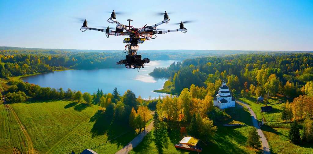
Real estate drone photography involves the use of unmanned aerial vehicles, commonly known as drones, equipped with cameras to capture aerial images and videos of residential, commercial, or industrial properties.
This innovative approach to photography has become increasingly popular in the real estate industry, offering a dynamic and unique perspective that traditional ground-level photography cannot achieve.
Key Elements of Real Estate Drone Photography:
- Aerial View: Drones provide the ability to capture images and videos from elevated angles, showcasing a property from a bird’s-eye view. This perspective is particularly valuable for highlighting the layout, features, and surrounding environment of a property.
- Property Scale and Proportion: Drones allow for the capture of large properties or expansive landscapes in a single frame. This helps potential buyers or renters understand the scale and proportion of the property about its surroundings, providing a more comprehensive view than conventional photography.
- Showcasing Features: Real estate drone photography is effective for highlighting specific features of a property, such as architectural details, landscaping, proximity to amenities, and the overall aesthetic appeal. This can significantly enhance the marketing materials used to promote a property.
- Marketing and Promotion: The captivating visuals produced by drone photography serve as powerful marketing tools. High-quality aerial shots and videos can be incorporated into online listings, promotional materials, and social media campaigns, attracting more attention from potential buyers or tenants.
- Virtual Tours: Drones can be used to create immersive virtual tours of a property, allowing viewers to navigate through the space and its surroundings. This interactive experience provides a more engaging and comprehensive understanding of the property.
- Cost-Effective Solution: Traditionally, obtaining aerial shots of a property required the use of helicopters or planes, which could be expensive and logistically challenging. Drones offer a cost-effective alternative, making aerial photography more accessible to real estate professionals, photographers, and even individual property owners.
- Technological Advancements: The continuous advancements in drone technology have resulted in improved camera capabilities, stabilization features, and longer flight times. This allows for higher-quality images and videos, even in challenging weather conditions.
- Legal Considerations: It’s important to note that drone operations are subject to aviation regulations and local laws. Operators must adhere to guidelines regarding altitude limits, no-fly zones, and privacy considerations. Familiarity with these regulations is essential for conducting legal and responsible drone photography.
Real estate drone photography has become an invaluable tool in the modern real estate market.
Whether used for residential listings, commercial properties, or expansive estates, the aerial perspective provided by drones adds a visually compelling dimension to property marketing, helping properties stand out in a competitive market.
Why Should I Do Real Estate Drone Photography?
As potential buyers and tenants increasingly turn to online platforms to explore properties, the need for visually captivating and informative content has never been more critical.
Enter real estate drone photography—a powerful tool that provides a fresh perspective, captivating audiences and setting your listings apart in a crowded market.
In this article, we’ll explore the compelling reasons why you should consider incorporating drone photography into your real estate marketing strategy.
1. Captivating Aerial Perspectives.
Drone photography allows you to showcase properties from breathtaking aerial viewpoints.
Potential buyers can appreciate the layout, features, and surroundings of a property in a way that traditional ground-level photography simply cannot convey.
This captivating perspective creates a lasting impression and generates increased interest in your listings.
2. Highlighting Property Features.
Drones provide the perfect vantage point to highlight specific features of a property, from architectural details to landscaping and outdoor amenities.
Whether it’s a sprawling backyard, a scenic view, or a unique architectural design, drone photography enables you to showcase these features in a visually stunning manner.
3. Comprehensive Property Overviews.
A single drone shot can capture the entirety of a property, giving potential buyers a comprehensive overview of its scale and proportions. This bird’s-eye view is invaluable for conveying the layout and spatial relationships between different areas of the property, providing a holistic understanding for viewers.
4. Increased Engagement and Interest.
The dynamic and engaging nature of drone photography attracts more attention from potential buyers. The visual appeal of aerial shots and videos encourages viewers to spend more time exploring your listings, ultimately increasing their engagement and interest in the property.
5. Differentiation in a Competitive Market.
As the real estate market becomes more saturated, finding ways to stand out is crucial. Properties with drone photography not only differentiate themselves but also convey a sense of innovation and commitment to providing a top-tier experience for potential buyers. This can give you a competitive edge in a crowded marketplace.
6. Enhanced Online Presence.
In the digital age, where online listings and virtual tours are the first points of contact for many buyers, having visually striking content is paramount. Properties with drone photography are more likely to attract online viewers, leading to increased website traffic, inquiries, and ultimately, higher chances of a successful sale or rental.
7. Cost-Effective Aerial Imaging.
Traditionally, capturing aerial shots of a property required expensive helicopter or plane rentals. Drones provide a cost-effective alternative, making aerial photography accessible to a broader range of real estate professionals. The initial investment in a quality drone and camera setup can quickly pay off in terms of improved marketing outcomes.
8. Interactive Virtual Tours.
Drone photography can be seamlessly integrated into interactive virtual tours, allowing potential buyers to navigate through the property and its surroundings.
This immersive experience provides a more comprehensive understanding of the space, fostering a deeper connection with the property.
How Can I Do Real Estate Drone Photography?
Enter real estate drone photography—an innovative and dynamic approach that provides a unique perspective, giving potential buyers a captivating view of properties.
If you’re a real estate professional, a photographer, or someone passionate about harnessing the power of aerial imagery, this comprehensive guide will walk you through the essential steps on how to do real estate drone photography.
Step 1: Obtain the Right Equipment.
To embark on your drone photography journey, you’ll need the right tools. Invest in a quality drone equipped with a high-resolution camera.
Drones from reputable manufacturers, such as DJI or Autel Robotics, offer excellent camera capabilities, stabilization features, and flight performance. Ensure that your chosen drone meets legal and safety requirements in your region.
Step 2: Learn and Understand Local Regulations.
Before taking to the skies, familiarize yourself with local drone regulations. Different regions may have specific rules regarding altitude limits, no-fly zones, and registration requirements. Adhering to these regulations is crucial for both legal compliance and ensuring responsible drone operation.
Step 3: Master Your Drone Flying Skills.
Practice flying your drone in an open, obstacle-free area to master basic flying manoeuvres.
Understanding how to control your drone effectively is essential for capturing smooth and stable aerial footage. Pay attention to altitude control, manoeuvring, and landing procedures to ensure a safe and controlled flight.
Step 4: Plan Your Shots Strategically.
Effective drone photography involves thoughtful planning. Before taking off, identify key angles and perspectives that will showcase the property’s features.
Consider the time of day for optimal lighting, and plan your flight path to capture a variety of shots, including close-ups of architectural details, expansive overviews, and shots that highlight the property’s surroundings.
Step 5: Camera Settings and Composition.
Adjust your camera settings to achieve the best image quality. Shoot in RAW format for greater flexibility in post-processing.
Experiment with different camera modes, such as aperture priority or manual mode, to control exposure and focus. Pay attention to composition principles, ensuring that your shots are well-framed and visually compelling.
Step 6: Safety First.
Prioritize safety throughout your drone photography session. Be aware of your surroundings, avoid flying in adverse weather conditions, and maintain a safe distance from people, buildings, and other obstacles. Regularly check your drone for any signs of wear or malfunction to prevent accidents.
Step 7: Edit and Enhance Your Footage.
Post-processing is a crucial step in refining your drone photography. Use editing software to enhance colours, contrast, and sharpness.
Correct any distortions or imperfections and ensure that your final images or videos present the property in the best possible light.
Step 8: Showcase Your Work Effectively.
Once you’ve captured stunning aerial shots, leverage them in your real estate marketing efforts.
Incorporate drone photography into online listings, property websites, and marketing materials.
Consider creating virtual tours or slideshows to provide a comprehensive visual experience for potential buyers.
Step 9: Stay Informed and Evolve.
The world of drone technology is ever-evolving. Stay informed about the latest advancements in drone technology, camera capabilities, and editing tools.
Continuously refine your skills and techniques to stay at the forefront of real estate drone photography.
Conclusion.
Real estate drone photography is a powerful tool for elevating your property marketing efforts.
By following these steps and embracing the possibilities of aerial imagery, you can create visually compelling content that captures attention, generates interest, and sets your listings apart in the competitive real estate market.
As you hone your skills and incorporate drone photography into your toolkit, you’ll discover the boundless potential of mastering the skies in the dynamic world of real estate.